
Shipping is not included in product prices and is charged separately.
Aerial & mobile mapping systems
Start with the site or corridor, sensor requirements and final output. Review capture, positioning, calibration and processing as one workflow.
The supplied configuration and included components are specified in your written quote.

Explore two system types
X500 · Aerial platform
Discuss the exact aircraft, payload, controller and processing configuration for the intended mapping task.
Explore X500
AU20 MMS · Mobile mapping
Discuss sensors, navigation, mounting, calibration and processing for the required corridor output.
Explore AU20 MMSDefine the result first
- Site or corridor conditions and access
- Required imagery, point clouds or mapping outputs
- Coordinate system, control and acceptance checks
- Sensor and software compatibility
- Operation, transport and support responsibilities
Review requirements before committing
Confirm the exact equipment configuration and applicable operating or procurement requirements for your project.
Choose the payload around the deliverable
Use orthographic imagery for top-down mapping, oblique imagery for visible building surfaces, and LiDAR for measured 3D point clouds and terrain workflows. The payload, positioning, flight plan and processing software work together; the aircraft alone does not define the result.

CHCNAV C5
Orthophotos and image-based mapping.
45 MP full-frame; one 35 mm lens; 290 g.
Ask GLG about this optionPhoto and specifications: CHCNAV manufacturer details ↗
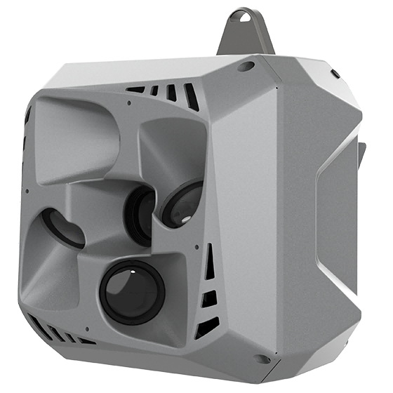
CHCNAV C30
Capture nadir and angled imagery for building facades and textured 3D models.
Five 26 MP cameras (130 MP total); 605 g.
Ask GLG about this optionPhoto and specifications: CHCNAV manufacturer details ↗
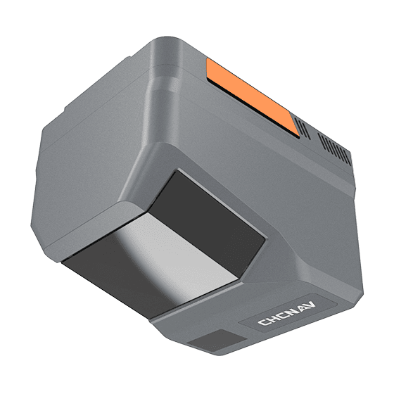
CHCNAV AlphaAir 6
Terrain, vegetation and corridor point clouds with integrated imaging.
1.35 kg; 25 / 100 MP imaging; up to 16 returns.
Ask GLG about this optionPhoto and specifications: CHCNAV manufacturer details ↗
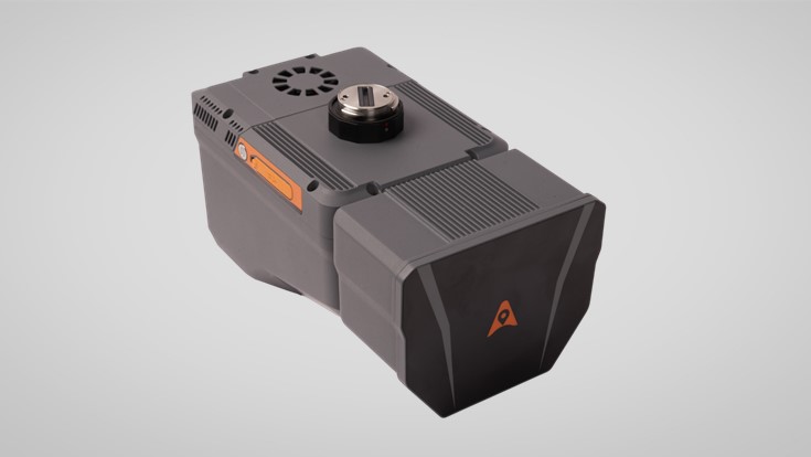
CHCNAV AlphaAir 6 Dual
Combine terrain point clouds with wider image coverage.
1.85 kg; two 26 MP cameras; 110° image FOV.
Ask GLG about this optionPhoto and specifications: CHCNAV manufacturer details ↗
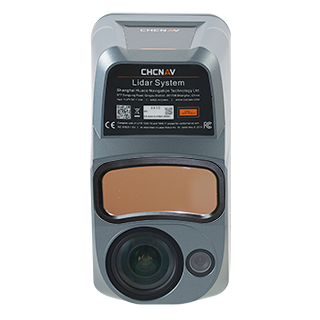
CHCNAV AlphaAir 10
Topographic point clouds and orthographic imagery in one capture workflow.
1.55 kg; 45 MP full-frame camera.
Ask GLG about this optionPhoto and specifications: CHCNAV manufacturer details ↗
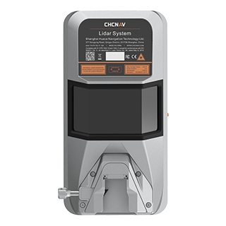
CHCNAV AlphaAir 15
Dense corridor and vegetation mapping with configurable imagery.
2.5 kg; 75° laser FOV; up to 16 returns.
Ask GLG about this optionPhoto and specifications: CHCNAV manufacturer details ↗
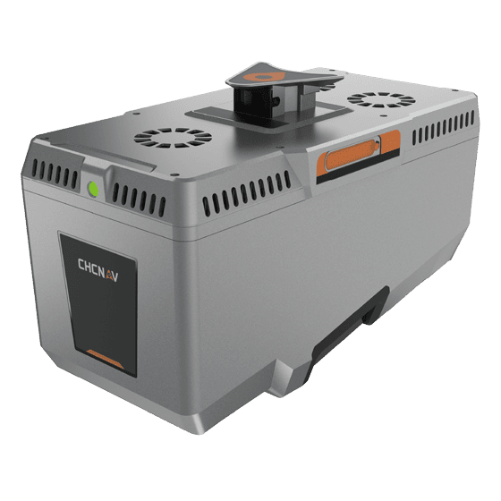
CHCNAV AlphaAir 15 Pro
Large-area terrain and corridor capture; imaging options for 3D modeling.
2.6 kg; up to 2.4 million pulses/s; up to 16 returns.
Ask GLG about this optionPhoto and specifications: CHCNAV manufacturer details ↗
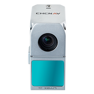
CHCNAV AlphaAir 450
A compact starting point for topography and infrastructure point clouds.
0.95 kg; 26 MP camera; up to three returns.
Ask GLG about this optionPhoto and specifications: CHCNAV manufacturer details ↗
| Payload | Capture / deliverable | Useful specifications | Platform check |
|---|---|---|---|
| C5 | Orthographic camera — Orthophotos and image-based mapping. | 45 MP full-frame; one 35 mm lens; 290 g. | CHCNAV lists X500 compatibility. |
| C30 | Oblique camera — Capture nadir and angled imagery for building facades and textured 3D models. | Five 26 MP cameras (130 MP total); 605 g. | Confirm the X500 mount and supplied configuration. |
| AlphaAir 6 | LiDAR + imagery — Terrain, vegetation and corridor point clouds with integrated imaging. | 1.35 kg; 25 / 100 MP imaging; up to 16 returns. | CHCNAV describes operation on X500. |
| AlphaAir 6 Dual | LiDAR + dual cameras — Combine terrain point clouds with wider image coverage. | 1.85 kg; two 26 MP cameras; 110° image FOV. | CHCNAV describes operation on X500. |
| AlphaAir 10 | LiDAR + RGB — Topographic point clouds and orthographic imagery in one capture workflow. | 1.55 kg; 45 MP full-frame camera. | Confirm interface, mission setup and payload configuration. |
| AlphaAir 15 | LiDAR with imaging options — Dense corridor and vegetation mapping with configurable imagery. | 2.5 kg; 75° laser FOV; up to 16 returns. | Confirm camera, mount and complete aircraft configuration. |
| AlphaAir 15 Pro | Long-range LiDAR — Large-area terrain and corridor capture; imaging options for 3D modeling. | 2.6 kg; up to 2.4 million pulses/s; up to 16 returns. | Aircraft integration and optional camera require configuration review. |
| AlphaAir 450 | LiDAR + RGB — A compact starting point for topography and infrastructure point clouds. | 0.95 kg; 26 MP camera; up to three returns. | CHCNAV lists DJI M300/M350 and BB4; confirm X500 suitability separately. |
Payloads are shown for comparison, not as a promise that every model is included or interchangeable on X500. GLG must confirm the exact airframe, mounting/interface, weight, camera, firmware and software combination. Flight endurance and accuracy depend on the full configuration and field conditions. Prices and package contents are available by inquiry.
Plan an aircraft and payload configuration